Press release -
Scientists determine cause of devastating Indian flood
A Northumbria University geomorphologist is among a team of international scientists to investigate the cause of the Uttarakhand flood in India earlier this year, which left more than 200 people dead or missing.
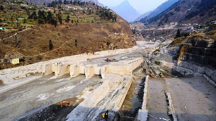
On February 7 the Uttarakhand region of India experienced a humanitarian tragedy when a wall of rock and ice collapsed and formed a debris flow that barreled down the Ronti Gad, Rishiganga, and Dhauliganga river valleys.
This massive slide was caused when a wedge of rock carrying a steep hanging glacier broke off a ridge in the Himalayan mountain range, leading to the destruction of two hydropower generating facilities, as well as massive loss of life.
In the days following the disaster, a team of 53 scientists came together to investigate the cause, scope, and impact of the flood and landslide. Among them was Dr Matt Westoby, of Northumbria University’s Department of Geography and Environmental Sciences.
The team analysed satellite imagery, seismic records, and eyewitness videos to produce computer models of the flow, with their findings published online today in the journal Science.
Dr Westoby’s research expertise includes the reconstruction of extreme glacial lake outburst floods. Speaking about his role in the project he said: “In the immediate aftermath of the so-called ‘Chamoli event’ I was fortunate to be able to work with a team of international experts to unravel the causes and impacts of this catastrophic flood.
“Using my experience in the geomorphological analysis of sudden-onset floods I assisted with rapid, initial estimates of the flood magnitude and other characteristics.
“We refined this understanding as more data became available, including invaluable observations from in-country partners.”
Lead author Dr Dan Shugar, Associate Professor in the Department of Geoscience at the University of Calgary, used high-resolution satellite imagery provided by MAXAR, PlanetLabs, and CNES to determine the cause of the Uttarakhand disaster.
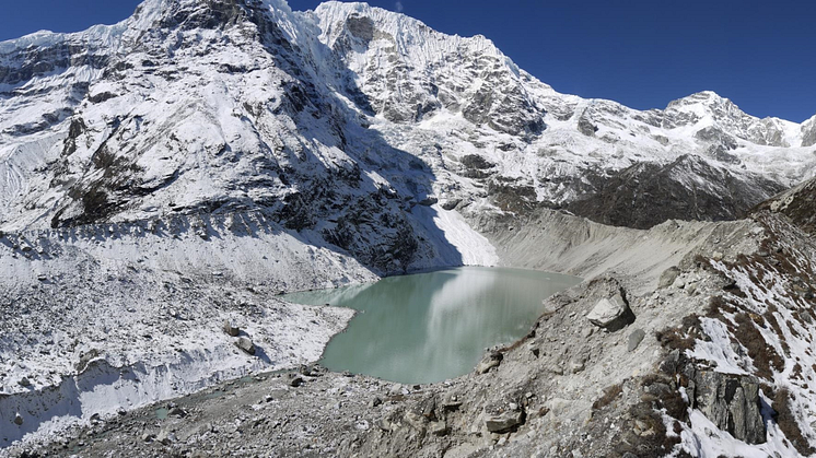
While initial suggestions pointed to a glacial lake outburst flood, Dr Shugar confirmed that there are no glacial lakes of any size large enough to produce a flood anywhere near the site.
“High resolution satellite imagery used as the disaster unfolded was critical to helping us understand the event in almost real time,” he said.
“We tracked a plume of dust and water to a conspicuous dark patch high on a steep slope. This was the source of a giant landslide that triggered the cascade of events, and caused immense death and destruction.”
The Science paper provided satellite evidence that previous large ice masses had been dislodged from the same ridge and struck the same valley area in recent years. The researchers suggest that climate change is contributing to such events happening more frequently, and that the greater magnitude of the latest disaster is an argument in favour of avoiding further developments in the area.
Dr Westoby is continuing to research the Chamoli event and was recently awarded a Natural Environment Research Council (NERC) Urgency Grant to estimate how quickly millions of cubic metres of new sediment deposited by the flood could be removed or modified by the river.
He will lead a team of scientists which includes researchers from the University of Leeds, Hull, and Newcastle University, who will work alongside a series of leading Indian and North American partners.
Speaking about this new project, Dr Westoby said: “The passage of this flood was a massive shock to the local river system. The next 12 months are a crucial period because this is when we predict that newly deposited sediments will be eroded and transported in vast quantities.
“These elevated sediment loads have implications for local hydropower operators and local authorities, who require forecast estimates of these loads to mitigate against further damage to key energy and transport infrastructure.
“We are using a state-of-the-art computer model to predict patterns and rates of river channel adjustment and are working closely with in-country partners to disseminate our findings to local stakeholders.”
Topics
Categories
Northumbria is a research-rich, business-focused, professional university with a global reputation for academic excellence. Find out more about us at www.northumbria.ac.uk --- Please contact our Media and Communications team at media.communications@northumbria.ac.uk with any media enquiries or interview requests ---


